CARTE DE LA TARTARIE ORIENTALE Map c1749
Check the listing for details.


USD 199.00
Condition: see listing
| Location | Littleton US |
| Shipping | Free shipping (check listing for details) |
| Seller |
jussho1773
100.0% positive · 70 feedback
|
| Listing | FixedPrice · Active |
| Start time | 2024-12-08T06:49:28.000Z |
CARTE DE LA TARTARIE ORIENTALE Map c1749 Specs
| Year | 1749 |
Listing details
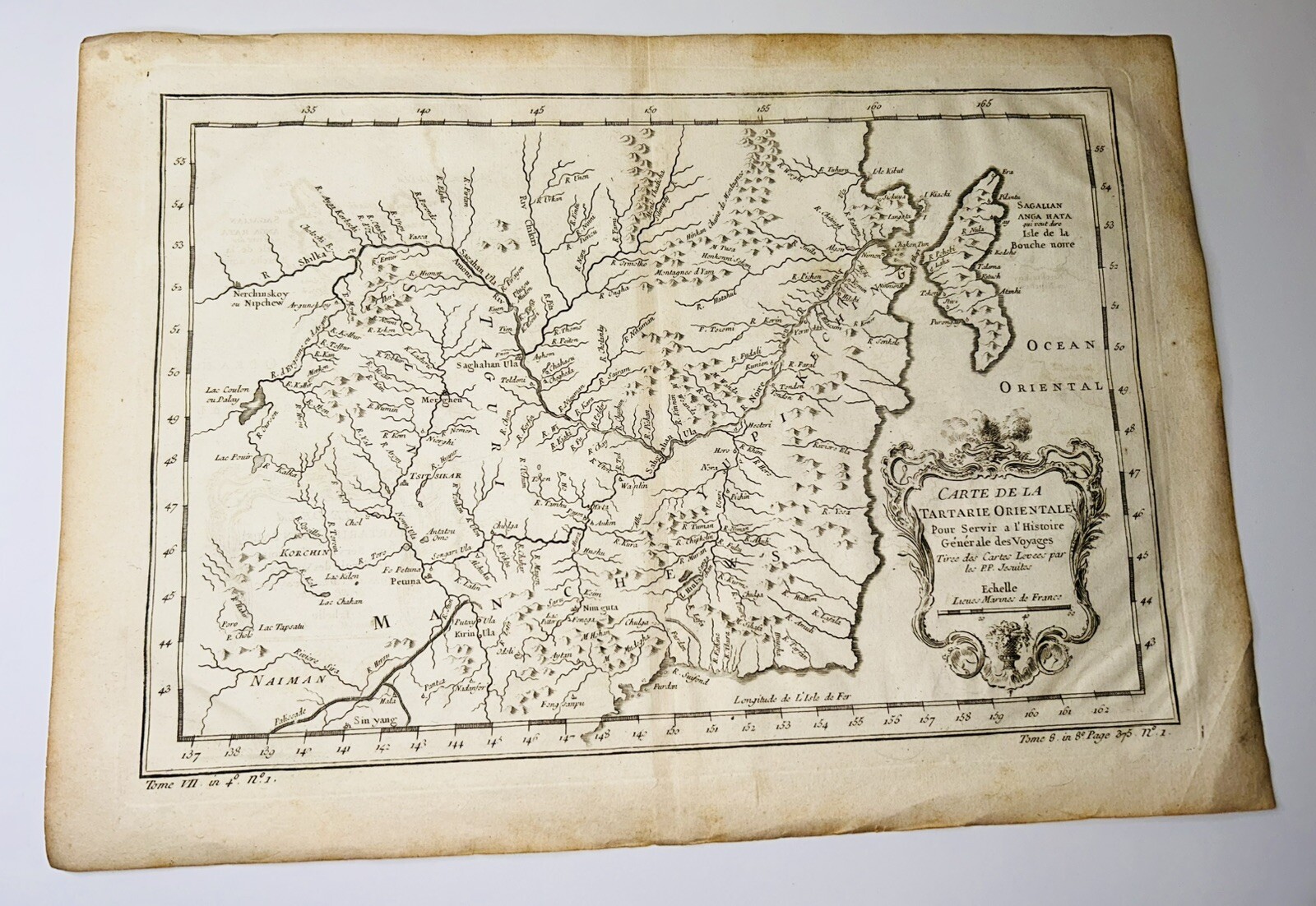
CARTE DE LA TARTARIE ORIENTALE.Paris: 1738 - 1775. Detailed copper engraved map of northeast Asia and Manchuria, showing the island "Sagallan Anga Hata" or "Isle de Bouche Noire". From Prevost's "L'Histoire Generale des Voyages".Bellin (1703 - 1772), one of the most noted French mapmakers of the 18th century, was named the hydrographer (chief cartographer) to the French Navy, and later, the Official Hydrographer to the French King.12 1/2 x 8 3/4", original center fold. Strong impression. Very Good condition with no tears
Related items

1576 Constantinople Ottoman Empire Historic Vintage Style Wall Map - 24x36

LAJORE 1914 ANTIQUE ORIGINAL MAP CITY PLAN لاہور لہور PUNJAB PAKISTAN guide

CARTE DE LA TARTARIE ORIENTALE Map c1749

1874 Antique Map of Southern Asia India Cashmere Tibet Mt Everest Siam China ++

1685 MAP of ASIA antique AUTHENTIC Tartaria Magna Mogoli Imperium RARE

Framed Matted 1860 S.A. MITCHELL MAP OF HINDOOSTAN FATHER INDIA CHINA TIBET

c1880s map of Asia Minor showing Armenia

Vintage 1936 Atlas Map Pre WW II China Japan Korea Thailand Vietnam Taiwan L@@K!

1911 Stieler Map Turkey Constantinople Iraq Palestine Syria Cyprus Jerusalem

1847 Stieler Map Asia China Japan India Tibet Mongolia Singapore Philippines

1903 Antique Map of India Tibet Ceylon Calcutta Bombay Madras British Empire

1904 RUSSO - JAPAN WAR MAP Reprinted in Japan in 1906 / Reverse Side Korea Info