Antique Map of Mississippi River Commission, Gold Dust Dam, 1900, 11x17
Check the listing for details.


USD 50
Condition: see listing
| Location | Tillamook, Oregon US |
| Shipping | Free shipping (check listing for details) |
| Seller |
sfiorelli
100% positive · 16 feedback
|
| Listing | FixedPriceItem · Active |
| Start time | 2024-09-10T00:59:33.000Z |
| End time | 2025-02-10T01:59:33.000Z |
| Time left | P25DT15H41M10S |
Antique Map of Mississippi River Commission, Gold Dust Dam, 1900, 11x17 Specs
| All returns accepted | ReturnsNotAccepted |
| Type | River Map |
| Year | 1900 |
| Format | Folding Map |
Listing details
For sale is an antique map from 1900, featuring the Mississippi River Commission’s map of Gold Dust Dam. Measuring 11 by 17 inches, this historical map is in good condition and has been carefully preserved. It is placed on a white mat board and enclosed in a protective sleeve to maintain its quality. The map highlights key details of the Gold Dust Dam and offers a glimpse into early 20th-century engineering and geography. This piece is framed and ready for display, making it a valuable addition to any collection of historical maps or River Commission memorabilia.
Related items
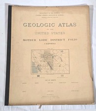
1900 Mother Lode District Folio #63 California USGS US Geologic Atlas Maps

Placerville California 1888 Historic Panoramic Town Map - 16x24

1830s Historic Map of Texas Land Grants - 16x20

Jacksonville Florida 1893 Historic Panoramic Town Map - 20x28

1907 CONNECTICUT - Map ORIGINAL LARGE (18X13) RAILROADS - COUNTIES TOWNSHIPS

1883 antique WOODSTOCK CT large foldout MAP linen backed by John S Lester 25x28
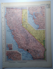
1957 Vintage CALIFORNIA Atlas Map Authentic Antique MCM Encyclopedia Britannica

1894 Vintage SUFFOLK, UK Atlas Map Authentic Antique Encyclopedia Britannica

1930s “Chicago” Vintage Style Panoramic Birds-eye View Map - 18x24

Vintage OHIO Atlas Map from a 1967 Mid-Century Modern World Book Atlas

1920 WILLOW Township IOWA Plat Map CRAWFORD COUNTY ORIGINAL (15x12)
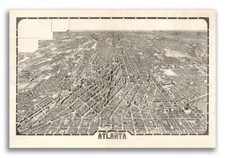
1919 Atlanta Georgia Vintage Old Panoramic City Map - 20x30