1998 Map| Sagamore Hill National Historic Site, New York, official map and guide
Check the listing for details.


USD 34.99
Condition: see listing
| Location | Toledo, Oregon US |
| Shipping | USD 0 · Flat |
| Seller |
new_york_map_company
99.3% positive · 1652 feedback
|
| Listing | FixedPriceItem · Active |
| Start time | 2023-06-29T21:52:29.000Z |
| End time | 2024-02-29T22:52:29.000Z |
| Time left | P24DT8H16M43S |
1998 Map| Sagamore Hill National Historic Site, New York, official map and guide Specs
| Restocking Fee | No |
| Return shipping will be paid by | Buyer |
| All returns accepted | Returns Accepted |
| Item must be returned within | 14 Days |
| Refund will be given as | Money back or replacement (buyer's choice) |
| Original/Reprint | Reprint |
| Framing | Unframed |
| Color | Black & White |
| Antique | No |
| Photographer | Unknown |
| Unit of Sale | Single Piece |
| Original/Licensed Reprint | Licensed Reprint |
| Format | Poster |
| Number of Photographs | 1 |
| Size | 24 inch |
| Features | Matte |
| Country/Region of Manufacture | United States |
| Material | Paper |
| Finish | Matte |
| Theme | History |
| Type | Map |
| Featured Person/Artist | Unknown |
| Year of Production | 1800-1950 |
| Image Color | Color |
| Subject | History |
| Production Technique | Giclee |
| Time Period Manufactured | 1800-1950 |
| Style | Documentary |
Listing details
Map Size: 24 inches x 24 inches | Fits 24x24
size frame | Frame not included | Archival Quality Reproduction | 1998 Map|Title: Sagamore Hill National Historic Site, New York, official map and guide|Subject: New York State|Oyster Bay|Sagamore Hill National Historic Site|Sagamore Hill National Historic Site Oyster Bay, N.Y|United States Each Map is Hand Printed in our Studio Fine Art Matte Paper (230g, 14mil) that maintains vivid colors and faithfulness to the original map. Archival inks guaranteed not to fade for 200+ years Your map will be shipped in a protective tube via first class mail Powered by SixBit's eCommerce Solution
Related items

Sydney Sweeney #005 Custom Actress ACEO Trading Card

Unopened Box 2025 Juicy Honey Plus 28 Miyu Aizawa Mayuki Ito Julia Cocoro Asano

Cindy Crawford 8x10 Celebrity Photo Picture Hot Sexy 2

Holly Hendix Film Star Unsigned Photo #93 International Model

Danielle Colby from American Pickers At The Beach …4 X 6Photo # 2

Trailer Tales Pic Signed By Jeremiah Watkins, Chelcie Lynn, Libbie Higgins

4x6 Color Photo Print Portrait Women Famous actress model Star Gy 82

ROBERTA PEDON #16 - 8.5x11 Vintage Pin-up
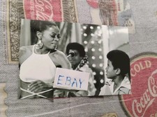
Diana Ross, Michael & The Jackson 5, The Hollywood Palace, Glossy B&W 4x6 Photo

Japanese Art Book "BISYOUJO-KIKO Vol.1 Eastern Europe Edition" | 1994

Vintage Hand Colored Photo In Frame My Garden Steps By L. S. Towner Signed

MAUREEN McCORMICK, MARCIA BRADY WEARING NO BRA EPISODE, GLOSSY COLOR 4X6 PHOTO