1837 Map of the Hawaiian Islands
Check the listing for details.


USD 30
Condition: see listing
| Location | Saint Augustine, Florida US |
| Shipping | USD 0 · Flat |
| Seller |
ancientcityart
99.7% positive · 1070 feedback
|
| Listing | FixedPriceItem · Active |
| Start time | 2019-07-26T21:31:53.000Z |
| End time | 2024-11-26T22:31:53.000Z |
| Time left | P10DT1H34M44S |
1837 Map of the Hawaiian Islands Specs
| All returns accepted | ReturnsNotAccepted |
Listing details
1837 Map of the Hawaiian Islands 18" x 26" Full Color Map Reproduction Made of heavy weight matte archival paper or Kodak Fine Art Canvas. (Canvas has a one inch boarder for mounting purposes.) This historic map shows historic places, historic place names, and more! A very colorful map! Great for research and display! Shipped in a roll map tube. Canvas Available by RequestMore Sizes Available by Request
Related items

LEROY NEIMAN + 1980's VINTAGE SIGNED PRINT FRAMED + " LENDL VS MCENROE "

Richard Tuttle 'Surface' Signed 1997 Original Color Photogravure- 34 Available!

VINTAGE FRENCH PRINT

Anastasia Inciardi Mini Print NEW Guinness

“The Godfather” Art Print Movie Poster By Ruiz Burgos RED FOIL VARIANT XX/100

ACEO Original PRINT Flowers and Books, Colorful flower aceo, Floral Books

Mew ex 232/091 Sv Paldean Fates Holo Display Case Extended Art for Pokemon Card
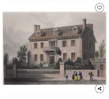
J. H. Hinton (British, 1791 - 1873) Hancock House, Boston

Helpless Girl Full Resin Figure Model Kit 1/24 Scale Unassembled Unpainted Toys

JEREMY WORST Art r2d2 Princess leia Poster Sexy Star Wars May the 4th be with yo

Digital File Poster

1565 Known World Map Gastaldi Bertelli Americas - 20x36