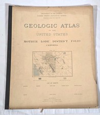
c1880 Mount Joy PA Township Map Plan Atlas – Antique History Names
This c1880 antique Mount Joy, Pennsylvania township map plan is a vintage atlas page featuring local history and business names. It’s a useful reference for collectors of antique maps, Pennsylvania ephemera, and local genealogy research. Condition is listed as: See listing description and photos; check the listing for details on any wear, toning, foxing, folds, or marks. Free shipping is included. Check the listing for details on exact measurements, publication source, and any additional information not shown here.


| Location | Avondale US |
| Shipping | Free shipping (check listing for details) |
| Seller |
ms.ebabe
100.0% positive · 6016 feedback
|
| Listing | FixedPrice · Active |
| Start time | 2025-12-11T15:40:53.000Z |
| US State | Pennsylvania |
| City | Mount Joy |
| Type | Physical Map |
| Format | Sheet Map |
| Date Range | 1800-1899 |
img c1880 antique MOUNT JOY pa TOWNSHIP MAP plan from atlas history business namesSCROLL DOWN for MORE PHOTOS in DESCRIPTION Click HERE to view or search ANTIQUE.COTTAGE listings. This listing is for the 15.5"x15.75" map shown. Clearly a page from an atlas. Undated, presumed 1880s. Secured behind plastic and on foam boardAuthentic period piece related to family, history or local heritage - well-suited for historical collections, genealogical /genealogy research, or museum acquisition. Vintage or Antique.CONDITION: See listing description and photos.- International buyers are responsible to pay VAT or other Taxes to their countries as required.- eBAY collects and remits sales tax on behalf of several states. If you are a dealer, you can write to eBay to file a form to become tax exempt. LOC: LOC2: K.CLOSET-TMKTK-F251021V1 Powered by SixBit's eCommerce Solution