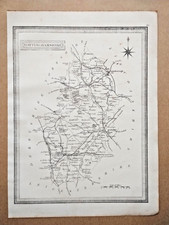
A. Vuillemin 1878 Hamburg & Elbe Estuary Antique Map, Original
This listing features an original antique map titled “1878 Hamburg & The Elbe Estuary” by A. Vuillemin, offered in the Antiques category. It can be a useful piece for collectors, framing, or historical reference, and the date and author are included for identification. Condition is not specified, so check the listing for details on wear, paper quality, or any marks. The price shown is 26.63 USD. Free shipping is included; check the listing for details on the shipping method, handling time, and delivery estimates.


| Location | Manchester GB |
| Shipping | Free shipping (check listing for details) |
| Seller |
diddersgoods
99.8% positive · 3592 feedback
|
| Listing | FixedPrice · Active |
| Start time | 2026-03-17T12:29:22.000Z |
| Antique | Yes |
| Type | Political Map |
| Year | 1878 |
| Era | 1800s |
| Cartographer/Publisher | A. Vuillemin |
| Original/Reproduction | Antique Original |
| Country/Region | Germany |
| Country of Origin | United Kingdom |
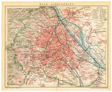
This colour map is from Universal Geography by Elisee Reclus, published by Virtue & Co., London, 1878.The map is coloured, printed on one side only and measures 34 cm x 27 cm.If you have any questions or would like to see more photographs then please do not hesitate to ask. This interesting map is an original antique which is over 135 years old. Please check my other listings for more antique, books, maps and engravings.Jacques Élisée Reclus (French: [ʁəkly]; 15 March 1830 – 4 July 1905) was a French geographer, writer and anarchist. He produced his 19-volume masterwork, La Nouvelle Géographie universelle, la terre et les hommes ("Universal Geography"), over a period of nearly 20 years (1875–1894). In 1892 he was awarded the Gold Medal of the Paris Geographical Society for this work.