Original 1899 Antique Map of UNITED STATES of NORTH AMERICA, 1783
Check the listing for details.


GBP 9.99
Not a modern reproduction, printed in 1899 - very good overall condition. Suitable for framing
| Location | Telford, Shropshire GB |
| Shipping | USD 24.02 · Flat |
| Seller |
issibeau-retro
100% positive · 5715 feedback
|
| Listing | FixedPriceItem · Active |
| Start time | 2024-10-22T16:53:14.000Z |
| End time | 2024-12-22T17:53:14.000Z |
| Time left | P5DT10H14M15S |
Original 1899 Antique Map of UNITED STATES of NORTH AMERICA, 1783 Specs
| Return postage will be paid by | Buyer |
| Returns Accepted | Returns Accepted |
| After receiving the item, your buyer should cancel the purchase within | 30 days |
| Date Printed | 1899 |
| Width (Inches) | approx 12cm |
| Listed By | Dealer or Reseller |
| Subject | Map |
| Originality | Original |
| Size | Small (up to 12in.) |
| Colour | Multi-Colour |
| Item condition | Very good |
| Height (Inches) | approx 18.5cm |
| Print Surface | paper |
| Listed by Self-Representing Artist? | No |
| Artist | Unknown |
| Year of Production | Printed in 1899 |
| Original/ Repro | Original |
| Source (Media Type) | Atlas |
| Verso | Blank |
| Type | |
| Original/Reproduction | Originally print from 1899 |
Listing details
Wonderful antique Longmans map of United States of North America, 1783.Not a modern reproduction, it has been rescued from an antique atlas from 1899. Image
size is approx 18.5cm x 12cm, with decent margins and suitable for mounting and framing. Reverse is blank. Gently aged paper, it's in very good condition for era...over 120 years old. Please take a look at our other great vintage, retro and antique items in our eBay store....with lots more to come. So do pop back!
Related items
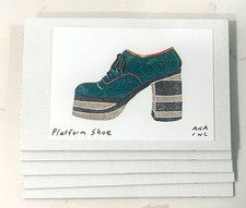
Anastasia Inciardi Mystery Pack of 6 Mini Prints Top Print Guaranteed No Doubles

ELVIS PRESLEY DRAWING PRINT PORTRAIT SKETCH 8" x 10" ELVIS PRESLEY WALL ART

Set of 3 Starter Pokemon TCG Art piece canvas wall home decor Portrait Gallery
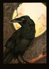
ACEO Original Art Card Limited Edition Print Raven Moon Ademade-stl

Thermistor NTC MF52B B3950 5kΩ, 10kΩ, 100kΩ enameled wire 60mm (5k, 10k, 100k)

MARC CHAGALL + 1973 BEAUTIFUL SIGNED PRINT FRAMED + BEAUTIFUL + BUY NOW!

8 x 10 inch Collectible Art Print Highest Quality Photo beauty lady women girl

P. J. Redoute Flowers CONVOLVULUS TRICOLOR Botanical Art Print Book Plate 74

PlayStation Logo - Custom FAT PlayStation 2 (PS2) Console Tray Sticker

Duke Kahanamoku - Famous Hawaiian Surfer - Vintage Photograph c.1915
3/12 Over 250+ Individual Mini Print LOOK Anastasia Inciardi Machine Prints

LEANINGTON GRAND STEEPLE CHASE 1837