MAPS SHOWING the DEVELOPMENT of PENNSYLVANIA -1920 - Reprint 1976 - LN
Check the listing for details.


USD 8.99
Like New
| Location | Avon, Indiana US |
| Shipping | USD 3.49 · Flat |
| Seller |
cecilavon
100% positive · 4377 feedback
|
| Listing | FixedPriceItem · Active |
| Start time | 2022-02-17T03:48:50.000Z |
| End time | 2024-10-17T02:48:50.000Z |
| Time left | P22DT12H51M27S |
MAPS SHOWING the DEVELOPMENT of PENNSYLVANIA -1920 - Reprint 1976 - LN Specs
| Restocking Fee | No |
| Return shipping will be paid by | Buyer |
| All returns accepted | Returns Accepted |
| Item must be returned within | 30 Days |
| Refund will be given as | Money Back |
| Original/Reproduction | Reproduction |
| Type | MAPS |
| Color | Black & White |
| Country/Region of Manufacture | United States |
| Subject | Mapping of Pennsylvania |
| Origin | United States |
| SIZE: 8 1/2" X 11"; 16 PAGES | REPRINT of 1920 DOCUMENT |
| Year | 1920 |
Listing details
This listing is for a like new copy of a reprint of an historical set of maps. Details as follows: TITLE: MAPS SHOWING the DEVELOPMENT of PEMMSYLVANIA PREPARED BY: The Land Office Bureau, Department of Internal Affairs - James F. Woodward, Secretary - 1920 (This is a reprint dated 1976) ABOUT THIS DOCUMENT:> Format: Set of maps (16 pages) - stapled (Facsimile)> Size: 8 1/2" x 11"; 16 Pages> Condition: Like New> Contents: Maps of Pennsylvania at various dates in its history SHIPPING: Document will be carefully packed and shipped promptly by USPS First Class Mail. I will combine shipments for multiple item purchases so that you will pay only the approximate actual cost of postage for the entire lot
Related items

MACY'S CHRISTMAS IN SNOW NEW YORK CITY 8x10 GLOSSY PHOTO PRINT

BARBINI FURS - SCRANTON PA - PREMIUM PRINT #149

EASTER BUNNY ARRIVING BY TRAIN IN SCRANTON PA 8 x 10 IN PREMIUM PRINT #30

1933 Sharptown Maryland street map 17"X20" Posters Great Detail
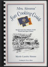
Mrs. Simms' Fun Cooking Guide Recipes New Orleans 2001 Cookbook Cajun Creole

Owego Bridge Port Jervis New York DE River New Metal Sign: 12x16 Ships Free

1947 Promotional Book Port Of Boston Authority What Ocean Shipper Should Know

COPY 1902 Creston Washington Street map 16X20" Poster Great Detail, Historians
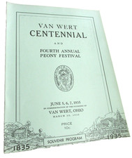
1935 VAN WERT OHIO CENTENNIAL CELEBRATION & 4th Annual Peony Festival Program

COPY 1909 Hartline Washington map 16X20" Poster Great Detail Historians
History Of Solano County Historical descriptive sketchbook Napa Sonoma Mendocino

Ridgway PA Pennsylvania Railroad DIECUT NEW 28" Wide Sign USA STEEL XL Size