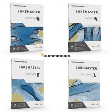
602002-1 LakeMaster Premium - Great Lakes V1
Check the listing for details.


| Location | shenzheng,guangdong CN |
| Shipping | Free shipping (check listing for details) |
| Seller |
sunglassesaccessory
100.0% positive · 1 feedback
|
| Listing | FixedPrice · Active |
| Start time | 2025-05-10T13:51:57.000Z |
| 2D Shaded Relief | Make bottom detail and depth changes easy to spot so you can quic |
| SmartStrike | Highlights areas of the lake map where fish are most likely bitin |
| Aerial Imagery | Navigate more confidently and find new fishing spots with the hel |
| Shallow Water Highlight | Easy-to-see red shading highlights shallow water areas on an adju |
| One-Boat Network | Connect your LakeMaster chart and Minn Kota trolling m |
| Chart Presets | Simple and easy to change between your own custom view settings. |
| Water Level Offset | Synchronize the depth contours and shorelines of your LakeMaster |
| VX Technology | Provides exceptional map performance and customizable color palet |
| Depth Highlight | Highlight a selected depth range so you can target productive wat |
Model Name LakeMaster Premium Power Source Battery Powered Display Type LCD Item Weight 0.01 Ounces About this item 2D Shaded Relief: Make bottom detail and depth changes easy to spot so you can quickly identify fish holding areas. Aerial Imagery: Navigate more confidently and find new fishing spots with the help of aerial imagery. VX Technology: Provides exceptional map performance and customizable
color palettes. SmartStrike: Highlights areas of the lake map where fish are most likely biting. *Select HD Lakes Only Chart Presets: Simple and easy to change between your own custom view settings. Depth Highlight: Highlight a selected depth range so you can target productive water and stay where the fish are. Shallow Water Highlight: Easy-to-see red shading highlights shallow water areas on an adjustable range from 0 to 60 feet. Water Level Offset: Synchronize the depth contours and shorelines of your LakeMaster charts with the actual water levels of lakes, reservoirs and rivers. One-Boat Network: Connect your LakeMaster chart and Minn Kota trolling motor, allowing your boat to automatically follow a depth contour line. Compatible with HELIX G3/G3N and newer, all SOLIX units and all APEX units. Product information
Brand porcelainplate Model Name LakeMaster Premium Power Source Battery Powered Display Type LCD Item Weight 0.01 Ounces Product Dimensions 5.5 x 5 x 0.5 inches Item Weight 0.01 ounces Item model number 602002-1 Best Sellers
Rank ,640 in Electronics (See Top 100 in Electronics) in Fish Finders & Depth Finders Connectivity technologies SD Card Other display features Wireless Color Black Whats in the box Micro SD Card; Micro SD Card Adapter; Quick Start Guide Department unisex-adult Manufacturer porcelainplate Country of Origin USA Date First Available October 16, 2022 From the manufacturer MAPPING TECHNOLOGY Everyday angler or weekend warrior. Saltwater or freshwater. On the beaten path or off the grid. No matter where the journey takes you, only Fishing Charts can gives you the detail, accuracy and innovative, one-of-a-kind features you need to eliminate unproductive water and find the best fishing spots faster. With multiple cartography options, you’ll make the most of every fishing day. READY TO FISH, RIGHT OUT OF THE BOX BASEMAP We’ve enhanced our standard basemap to deliver more detail and a superior angling experience. The Basemap is built into all APEX Series, SOLIX Series and GPS-equipped HELIX Series G2/G2N and newer models. Based on freshwater data from LakeMaster and NOAA, the most-trusted saltwater source, these accurate maps provide you with a clear view of underwater terrain. Identify buoys, daymarkers, hazards, marinas and countless other navigation aids and points of interest with our comprehensive icon system. You’ll also see depth contours and spot soundings for coastal areas. On the water, confidence is key. And the Basemap delivers. OWN THE WATER LAKEMASTER LakeMaster maps with VX Technology deliver an exact understanding of the bottom terrain, and powerful features to eliminate unproductive water, including SmartStrike technology, Depth Highlight, Shallow Water Highlight, and Water Level Offset. And for an added advantage, upgrade to LakeMaster Premium, with all the features on LakeMaster, plus Aerial Imagery and 2D Shaded Relief layers. FROM SEA TO SHINING SEA COASTMASTER Find the path to your next big catch with the incredible accuracy and detail of CoastMaster and CoastMaster Premium charts. With easy-to-read contours and chart customization, you'll have the tools you need to identify the spots you know will hold fish and navigate there safely. Building on the latest data available, CoastMaster charts deliver unrivaled nearshore and offshore fishing performance. Product Description LakeMaster® Maps deliver unrivaled detail, accuracy and innovative, one-of-a-kind features you need to eliminate unproductive water and find the best fishing spots faster. h3


![Humminbird 602008-1 LakeMaster VX Premium [Southeast States V1] APEX/SOLIX/HELIX](https://i.ebayimg.com/images/g/5~4AAeSwDphpOJVs/s-l225.jpg)